What is a Nautical Chart Really? The concepts of internal and external geometry applied to early modern nautical charts
Faculdade de Ciências da Universidade de Lisboa, Edifício C8, Sala 8.1.67
15 November 2019 · 10h30
Abstract
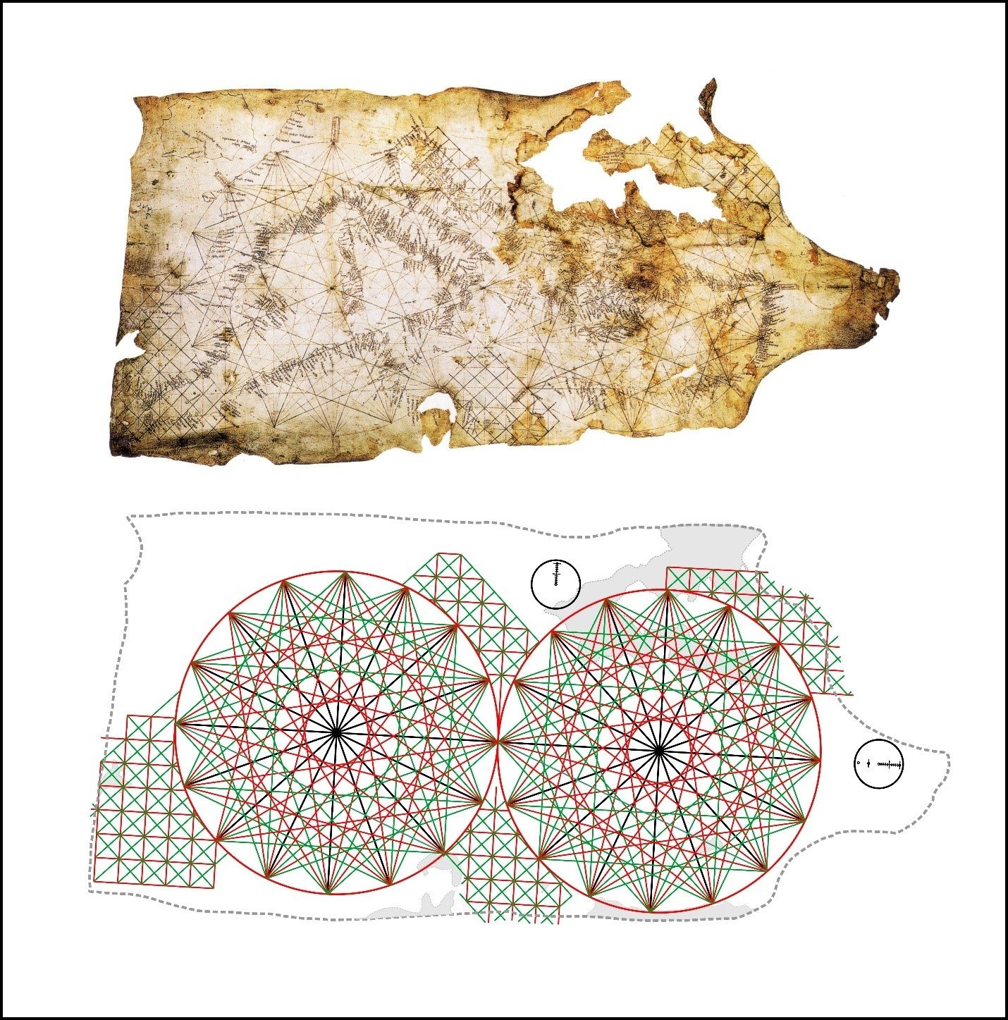
The pre-Mercator nautical chart is an amazing artefact of unexpected complexity. Not because its construction relied on sophisticated methods but, on the contrary, owing to the limitations imposed by contemporary navigation, which prevented the adoption of the cartographic paradigms prescribed by Ptolemy on his Geography – that is – the use of latitudes and longitudes in chart making. Those limitations were the impossibility of determining longitude on board and the errors caused by the uncorrected magnetic declination on the directions measured with the marine compass and transferred to the charts. In this talk the geometry of the medieval and early modern nautical chart is described. The concepts of internal and external geometry of the charts are introduced, which help to better identify the distortions affecting them and how the contemporary navigators dealt of the problem.